Camí de Ronda Lloret: complete coast walk beach to beach 2026
Camí de Ronda Lloret de Mar: complete Fenals-Lloret-Tossa walk with distances, difficulty, cove by cove, best time of year and practical tips.
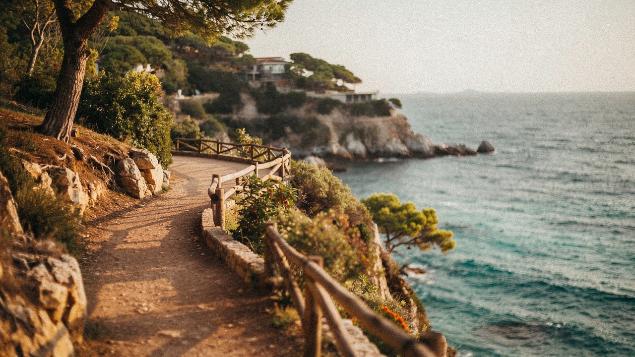
The Camí de Ronda is the historic coast path that runs along the Costa Brava from Blanes to Portbou on the French border. The Lloret de Mar section is one of the most walked because it links coves, viewpoints and two neighbouring towns (Blanes to the south, Tossa de Mar to the north) in stretches that are doable for anyone with average walking fitness.
This guide covers the Lloret-Tossa stretch in detail (the most spectacular section), plus the shorter options inside the Lloret municipality if you just want to walk for a couple of hours.
If you’re still planning the trip, have a look at the complete guide to what to do in Lloret de Mar.
The full Lloret → Tossa walk: in one line
11 km · 3.5–4 hours at an easy pace · moderate difficulty (climbs and stairs) · spectacular landscape
You leave from the northern end of Lloret beach (marina area), climb stairs to the first viewpoint, and from there the path alternates pines, cliffside viewpoints, coves, stone staircases and built-up sections. You reach the medieval castle of Tossa from the southern approach.
Stretch by stretch: coves and viewpoints
Lloret → Cala Banys (1.5 km, 25 min)
Start of the Camí de Ronda. Climb stairs to the first viewpoint (view of the whole Lloret bay and Castell d’en Plaja). Down to Cala Banys (rocky cove with a clifftop restaurant — good for a coffee).
Cala Banys → Cala Trons (1 km, 20 min)
Path through pines with continuous sea views to the right. Arrival at Cala Trons (small sandy cove, good first swim spot if you’ve got time).
Cala Trons → Cala dels Frares (1 km, 25 min)
The path turns more technical (rocks, gradient). Cala dels Frares is small, empty, with crystal-clear water.
Cala dels Frares → north stretch
From here you decide:
- Option A (back): retrace your steps or climb to the road and return by bus/taxi. 2.5 km covered, 1.5 hours. Plenty if you don’t want the full walk.
- Option B (carry on to Tossa): keep heading north, across residential developments and coast paths to Tossa. 8.5 km more, 3 additional hours.
If you’re heading to Tossa: the full Lloret → Tossa stretch
| Point | Km from start | Time |
|---|---|---|
| Lloret start (marina) | 0 | 0:00 |
| Cala Banys | 1.5 | 0:25 |
| Cala Trons | 2.5 | 0:45 |
| Cala dels Frares | 3.5 | 1:10 |
| Cala Canyelles development | 5 | 1:45 |
| Cala Llevadó (viewpoint) | 7 | 2:30 |
| Cala Bona (viewpoint) | 8.5 | 3:00 |
| Tossa de Mar (southern entry) | 11 | 3:45 |
Short walk inside Lloret: Fenals → Lloret → Cala Trons (recommended for first-timers)
5 km · 1.5 hours · easy-to-moderate difficulty
The urban section of the Camí de Ronda, entirely inside the Lloret municipality:
- Start at the northern end of Fenals
- Past Sa Boadella (optional swim stop)
- Across central Lloret along the seafront
- Climb north toward Cala Banys
- Arrive at Cala Trons
Perfect first-time route or for anyone without a full day to spare. Combines sea, town and woods.
Logistics
When to go
Best time: April to June + September-October. The temperature is perfect for walking (15–25 °C), the coves are empty for a proper swim, the views are at their clearest.
Avoid: July and August at midday (fierce heat, no continuous shade). If you’re going in peak summer, set off at 8:00 or after 18:00.
After rain: the path has dirt and rock sections that can be slippery. After heavy rain, wait 1–2 days.
Getting back if you do the full walk
If you complete Lloret-Tossa (11 km), you have three return options:
- Bus from Tossa to Lloret — regular Sarfa/Moventis line, 25 min, ~3–4 €. The most practical option.
- Taxi Tossa-Lloret — 25–35 €.
- Walk back the same way — adds another 11 km, very long day. Only if you have the fitness and the time.
Minimum kit
- Closed-toe walking or sports shoes (no flip-flops)
- A small backpack
- Water (at least 1.5 L in summer)
- 30+ sunscreen
- Sandwich or snacks
- Swim shorts and a towel if you’ll get in the water
- A cap
- Phone charged + offline GPS (Maps.me, Mapy.cz)
Extra kit for the full Lloret-Tossa walk
- Basic first-aid kit
- Portable charger
- A more substantial bit of food (no shops past Cala Trons)
- Extra sunscreen for reapplying
What to wear
Breathable clothes, short-sleeved t-shirt (long sleeves get hot in summer), shorts or long trousers depending on preference, hat. A light jumper for the viewpoint at sunset if you come back late.
Real difficulty
Physical: moderate. The path has 200–300 m of total elevation gain, with stair sections and short but demanding climbs. It’s not mountain walking, but it isn’t a flat stroll either. If you regularly walk 2–3 km without effort, you can do it.
Technical: low-to-moderate. Most of it is a clear marked path (GR-92). Some sections have rocks or uneven stone stairs that need attention. Proper footwear matters.
Time: 3.5–4 hours for the full Lloret-Tossa at an easy pace, no long stops. With stops (swims, lunch, viewpoints), add another 2–3 hours.
What most guides don’t tell you
1. The Cala Llevadó to Cala Bona stretch (north of Cala Canyelles) is the most spectacular: cliffs, century-old pines, views that look painted. If you can only do one stretch between Lloret and Tossa, prioritise this one.
2. The stairs up from Cala Banys at the start are the most demanding. After that, the path moderates. Don’t get scared if you arrive at the top of the first climb tired.
3. There are built-up sections (Cala Canyelles, La Riviera) that break the natural rhythm. They aren’t ugly, but you expect 100% nature and sometimes find yourself walking past a residential street.
4. The signage (GR-92 with red-and-white marks) is good but not perfect. At junctions with secondary paths, always check the marks before continuing.
5. The midday sun is fierce with no continuous shade. In summer, this isn’t optional: either you set off very early or after the worst of the heat.
Combinations with other plans
- Walk + swim + lunch in Tossa: do the full route, eat in Tossa, bus back. A complete day.
- Walk + Santa Clotilde Gardens: drop down to the gardens (about halfway, in the southern section) + carry on afterwards.
- Short walk + sunset at Cala Banys: Fenals-Lloret-Cala Trons stretch + back with a drink at the Cala Banys restaurant.
Frequently asked questions
Suitable for children? Children 8–9 and up can manage short stretches without trouble. For the full Lloret-Tossa, better 12+ or very good fitness.
Dog-friendly? Yes, perfectly. Lead in built-up sections, water for the dog, and a return plan (some buses don’t allow them).
Can you cycle it? Not the main path. There are parallel cycling routes on minor roads, but it isn’t the same thing.
Risk of getting lost? Low if you follow the GR-92 marks. Carry an offline map as backup. The built-up sections can be confusing first time.
Which stretch is hardest? The initial climb up from Cala Banys + the stair section at the end (entering Tossa). The rest is a manageable path.
In short
The Lloret-Tossa Camí de Ronda is one of the best walks on the Costa Brava for anyone with a day to spare and reasonable legs. It isn’t mountain walking but it is real effort, with a spectacular payoff: 11 km of unspoilt coast with optional swims, viewpoints and two iconic towns. To start, do the short Lloret-Cala Trons stretch (1.5 hours) and, if you still want more, complete the route to Tossa another day.
For more small coves you can visit on foot, follow on to the hidden coves of Lloret, or if you’d rather one specific natural cove, Cala Sa Boadella is just south of the centre.